Benvenuto in Giroviaggiare.it
Albania - Un paese da scoprire
- Dettagli
- Scritto da Luc
- Categoria principale: Europa
- Visite: 7608
Anche quest'anno, come sempre, presi dai molti impegni lavorativi e dal poco tempo, abbiamo cercato di organizzare un viaggio che potesse darci il mare e nel contempo farci rilassare. Non è stata una scelta facile, perché nella maggior parte dei casi si parlava di mete turistiche. E quando dici turistico allora parli di luoghi affollati, prezzi esagerati, movida. Niente di quello che cercavamo. Così, forti di un'esperienza non nostra, ci siamo lasciati convincere per l'Albania. Un paese misterioso, perché ai più è conosciuto per i noti fatti di guerra degli scorsi decenni e per non essere esattamente un esempio di civiltà. Quello che abbiamo trovato è una nazione che sta cercando di risollevarsi, che ha tanta strada da fare ma che vuole percorrerla, soprattutto con l'aiuto degli italiani, i cugini dall'altra parte del mare.
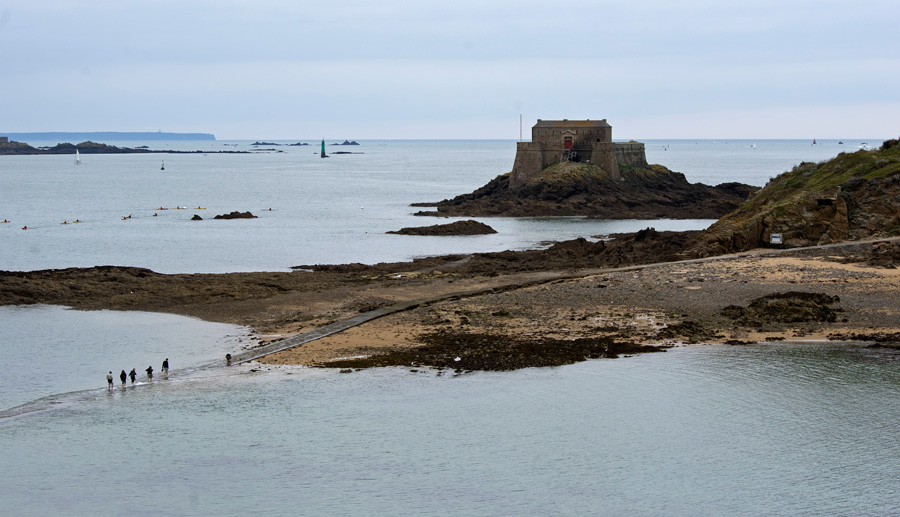
Il nostro itinerario prevedeva la traversata Bari-Durazzo in traghetto, con le auto, ed un viaggio che ci avrebbe portato a sud, verso Saranda, quasi al confine con la Grecia.
Arrivati a Durazzo ci siamo diretti nella vicina Golem, dove abbiamo pernottato. Lì sono ancora presenti le torrette bunker da dove venivano controllate le spiaggia e le strade durante la guerra. La cosa singolare è che non sono state distrutte per far spazio a nuove strutture, ma sono rimaste o abbandonate alle intemperie e alla furia del mare e chiuse in mezzo alle costruzioni, come a voler mostrare quello che è stato il passato recente.
Dopo il breve soggiorno, ci siamo incamminati verso Saranda. Un viaggio lungo 6 ore, attraverso quella che è l'unica "autostrada" del paese. In realtà dall'aspetto è simila ad una italianissima strata statale, non illuminata, che passa in mezzo alle montagne, ricca di tornanti e tratti non asfaltati, ma comunque suggestiva nel panorama che la circonda.
Giunti a Saranda intorno alle 16, siamo rimasti stupidi del luogo scelto per trascorrere la settimana. Un piccolo complesso di appartamenti costruito a ridosso del mare, con bar sulla spiaggetta, ombrelloni privati, parcheggio privato e wifi. La cosa più bella era svegliarsi al mattino e ammirare Corfù, a pocho chilometri da noi.
Saranda, rispetto al nord dell'Albania, è sicuramente più turistica e sviluppata. Possiede molti ristoranti di vario genere, la cucina è quasi sempre apprezabile per noi italiani. Si vedono ancora i preconcetti della vecchia civiltà albanese, dettati dal regime comunista o dalla religione musulmana, professata dalla maggioranza. Cibi come la carne di maiale vengono serviti ma c'è qualche difficoltà nel trovare qualche ristorante. Come città di mare va molto il pesce. Mentre il piatto tipico è il capretto al forno. Il tutto, ahimé, povero di condimenti e spezie.


{jcomments on}
Commenta (0 Commenti)Vasto e la costa dei trabocchi
- Dettagli
- Scritto da Manuel
- Categoria principale: Italia
- Visite: 9235

Il mare di settembre è stata una scoperta. Poca gente, caldo non asfissiante, spiagge semi deserte. E l'acqua per niente fredda. L'Abruzzo è una regione fantastica, e tra mare e montagna mi ospita sin da quando sono bambino. Questa volta a Marina di Vasto, il litorale su cui domina dall'alto il bellissimo borgo omonimo, Vasto.
Partiamo subito dall'acqua, visto che quando si va al mare vogliamo sapere come sarà tuffarsi tra le onde. La mattina l'acqua è bassa, davvero bassa, e cristallina. Per farsi una nuotata bisogna camminare molto. Il pomeriggio, complice il vento, si alzano le onde e il mare diventa torbido, ma parliamo sempre di bandiera blu, quindi non ci vedremo i piedi ma siamo sicuri che l'acqua sia poco contaminata.
Vasto si trova sulla Costa dei Trabocchi, queste costruzioni di legno sul mare che servivano un tempo per la pesca ma che oggi immagino siano quasi tutte dei ristoranti. Da Ortona a San Salvo percorrete l'adriatica piuttosto che l'autostrada. Andatura più bassa, paesaggio incredibile, selvaggio, bello.

Spiagge quante ne volete. Sabbia o sassi, c'è tutto. Marina di vasto è completamente sabbiosa, spiaggia grande di sabbia chiara. Se volete prendere la macchina e allontanarvi un pò le spiagge più belle della zona sono quelle verso Punta Aderci, la riserva naturale che si trova a una decina di chilometri da Vasto.
Punta penna (foto sopra) è una spiaggia meravigliosa, selvaggia, immensa, piena di verde. Si trova vicino al porto di Vasto, nella parte sud della riserva di Punta Aderci.
La spiaggia di Mottagrossa invece è di sassi, è leggermente più complicato andarci (soprattutto con bambini piccoli perché c'è da camminare di più), ma offre una vista speciale sul trabocco che ahimè aveva la passerella in parte crollata. La vista dal promontorio di Punta Aderci, proprio sopra la spiaggia di Mottagrossa merita una passeggiata anche senza necessariamente scendere al mare.


Se siete in zona non fatevi mancare una passeggiata nella vicina Termoli, che dista solo 30km. Da qui partono i traghetti per le isole Tremiti. Ho trovato Termoli bellissima, molto piacevole, con il suo corso che finisce a ridosso delle mura vecchie dove parte una seconda passeggiata sopra il mare, tra i vicoli vecchi, il duomo. Molto viva, anche a settembre, gente sempre sorridente e piacevole. Il mare rispetto a vasto la sera è calmo, molto spesso anche da quello che mi dicevano gli abitanti del posto.

Se appassionati del periodo storico della seconda guerra mondiale sappiate che nella parte alta della Costa dei Trabocchi, verso Ortona, ci sono diverse testimonianze delle battaglie che si sono tenute su queste coste, ed è possibile visitare diversi cimiteri militari, tra cui quello canadese ed inglese.


Palazzo Sforza Cesarini di Genzano
- Dettagli
- Scritto da Manuel
- Categoria principale: Italia
- Visite: 8504
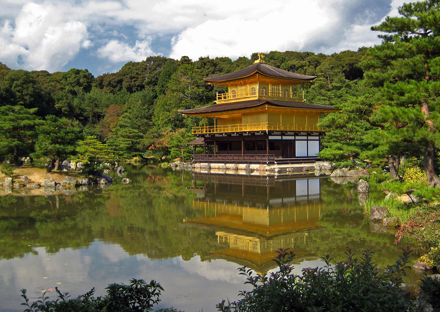
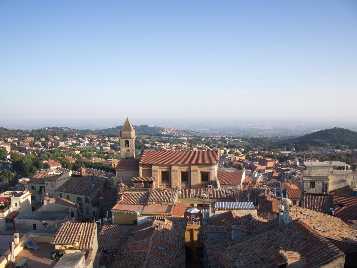
Il palazzo ducale di Genzano di Roma, il palazzo Sforza Cesarini, che nella foto qui sopra non ha giustizia, merita una visita per il costo contenuto (la visita è guidata) e per la vista dalla terrazza che domina tutta genzano e il lago di Nemi. Dentro non c'è molto, arredi non ce ne sono, nel giorno della nostra visita il palazzo era custode di una mostra di quadri. C'è qualche affresco, poco di più, per colpa dei saccheggi avvenuti nel corso dei secoli.
Il castello era il punto di passaggio per entrare nella cittadina di Genzano. Due enormi portoni sono stati negli anni il transito di migliaia di pellegrini, e anche quando il palazzo era abitato il passaggio non è mai stato negato. Inoltre ha ospitato diversi artisti famosi che venivano in Italia per il Gran Tour d'Italié!
In cima al palazzo poi la vista che spazia oltre i 180 gradi è fantastica. Si domina il borgo di Genzano e il lago di Nemi. Davvero una vista incredibile che forse da sola merità il costo del biglietto.


Grotte dell'Arco
- Dettagli
- Scritto da Manuel
- Categoria principale: Italia
- Visite: 7958
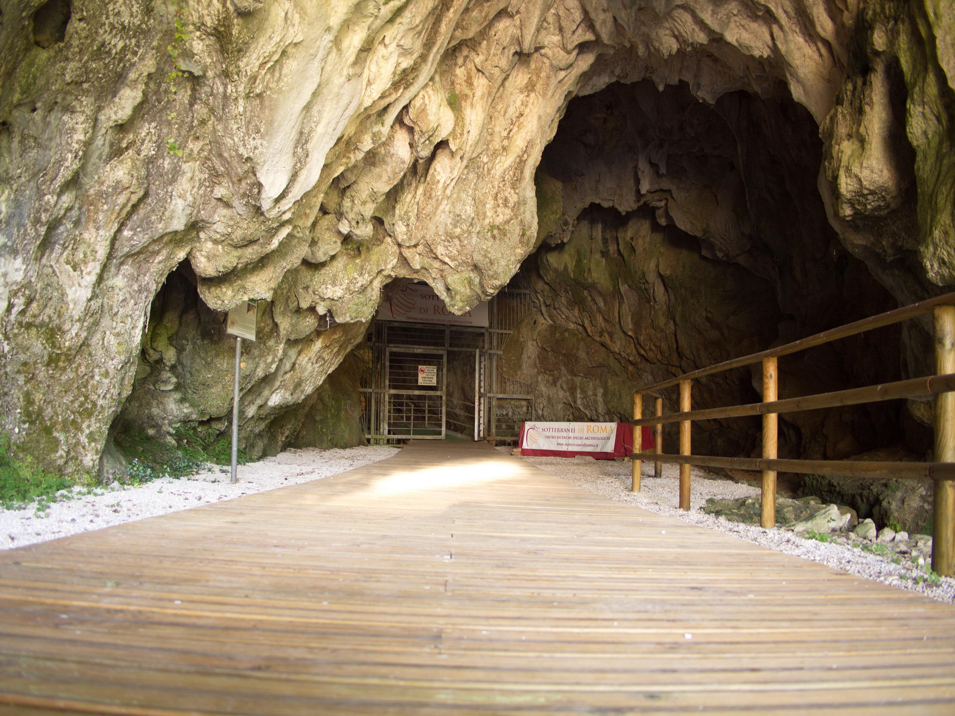
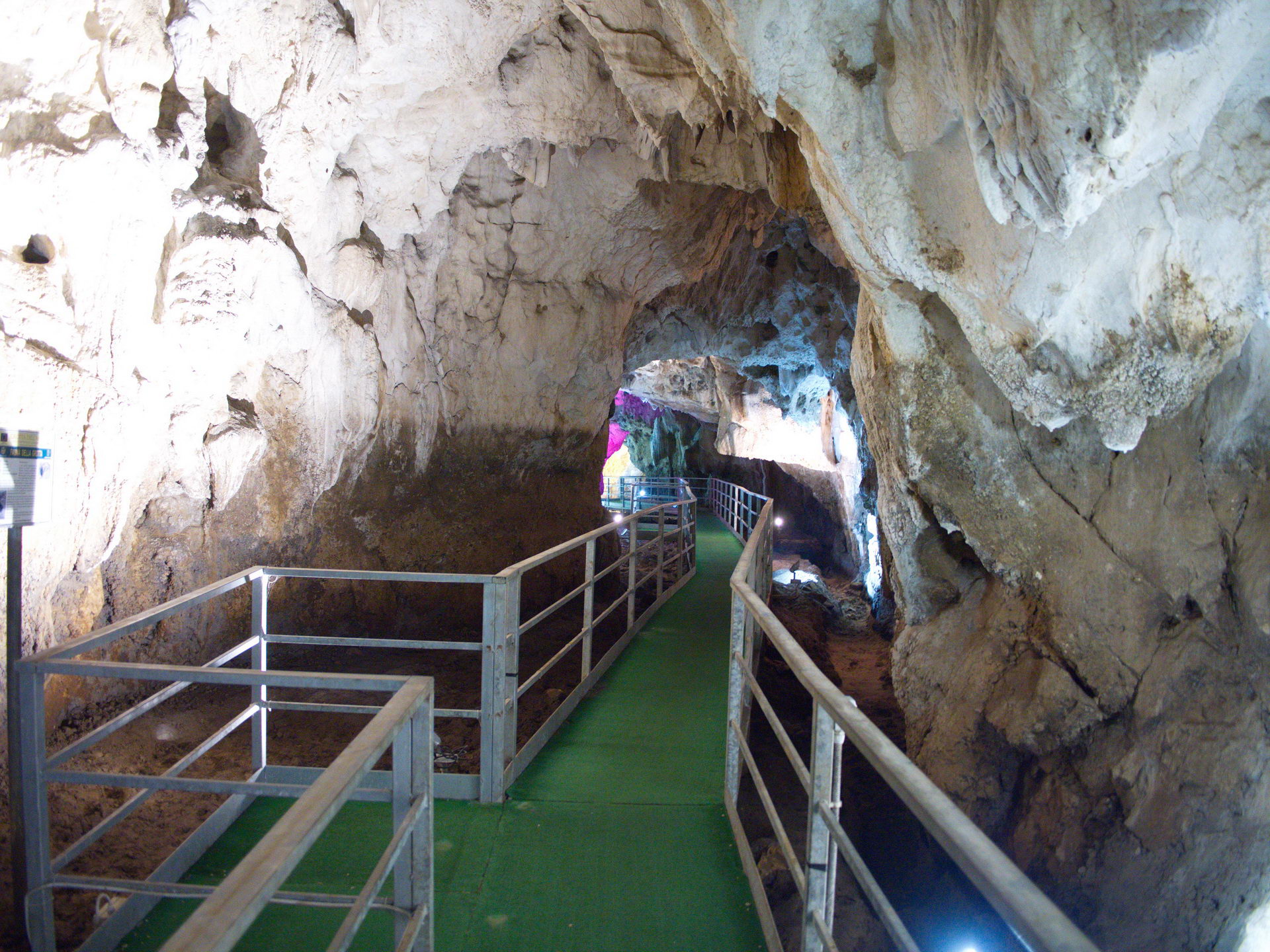
In località Bellegra è possibile visitare le Grotte dell'Arco, che prendono il nome da un arco naturale di roccia poco prima del loro ingresso. Sconosciute ai più al punto che persino in paese dubitano se siano aperte o meno, sono state prese in gestione dai Sotteranei di Roma e gestite da volontari.
È bene ricordarsi di indossare un giacchetto all'interno delle grotte, e non fare come i nostri compagni di avventura che sono venuti quasi in costume, con i bambini tremolanti vista la temperatura decisamente bassa all'interno e la tantissima umidità.
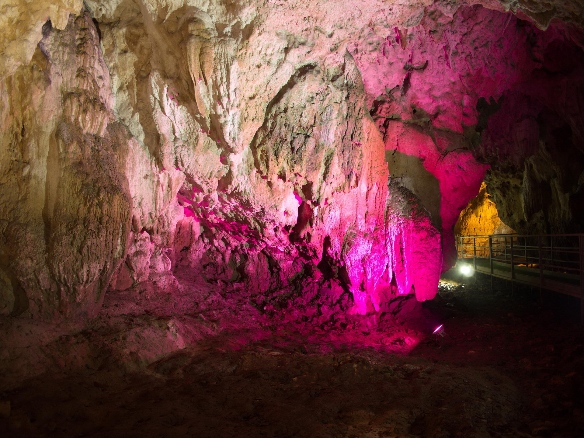
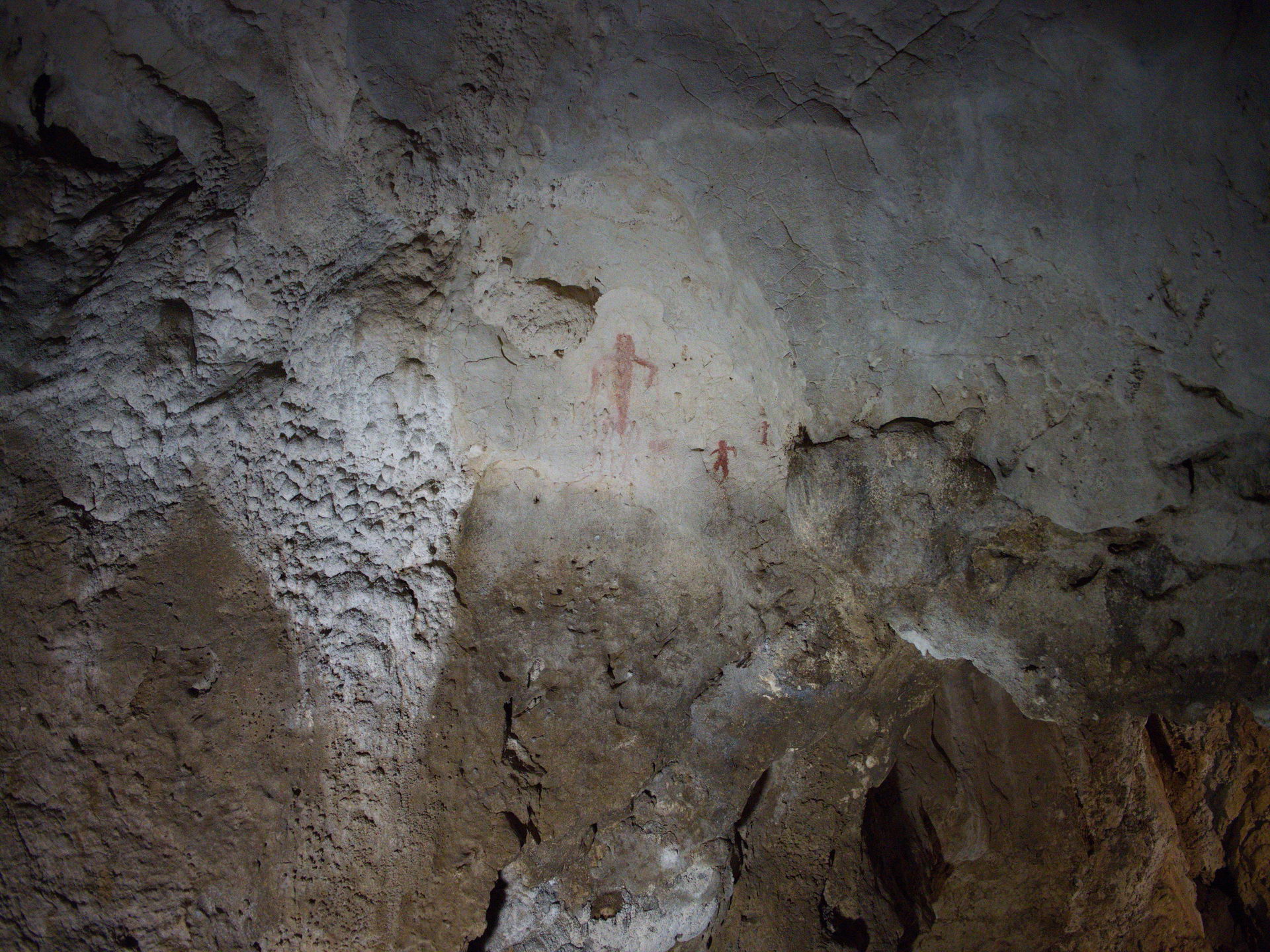
Le grotte sono state abitate migliaia di anni fa da uomini e da animali, tra cui una specie di orso alta 3 metri. Alcune pitture testimoniano il passaggio dell'uomo all'interno delle grotte. Ma anche cinquant'anni fa l'uomo ha fatto visita alle grotte, non per trovarne riparo ma per farne scempio. Scritte (che ora non ci sono) e stalattiti o stalagmiti divelte. Distruggere in cinque minuti quello che la natura ha compiuto in migliaia di anni. Niente male.
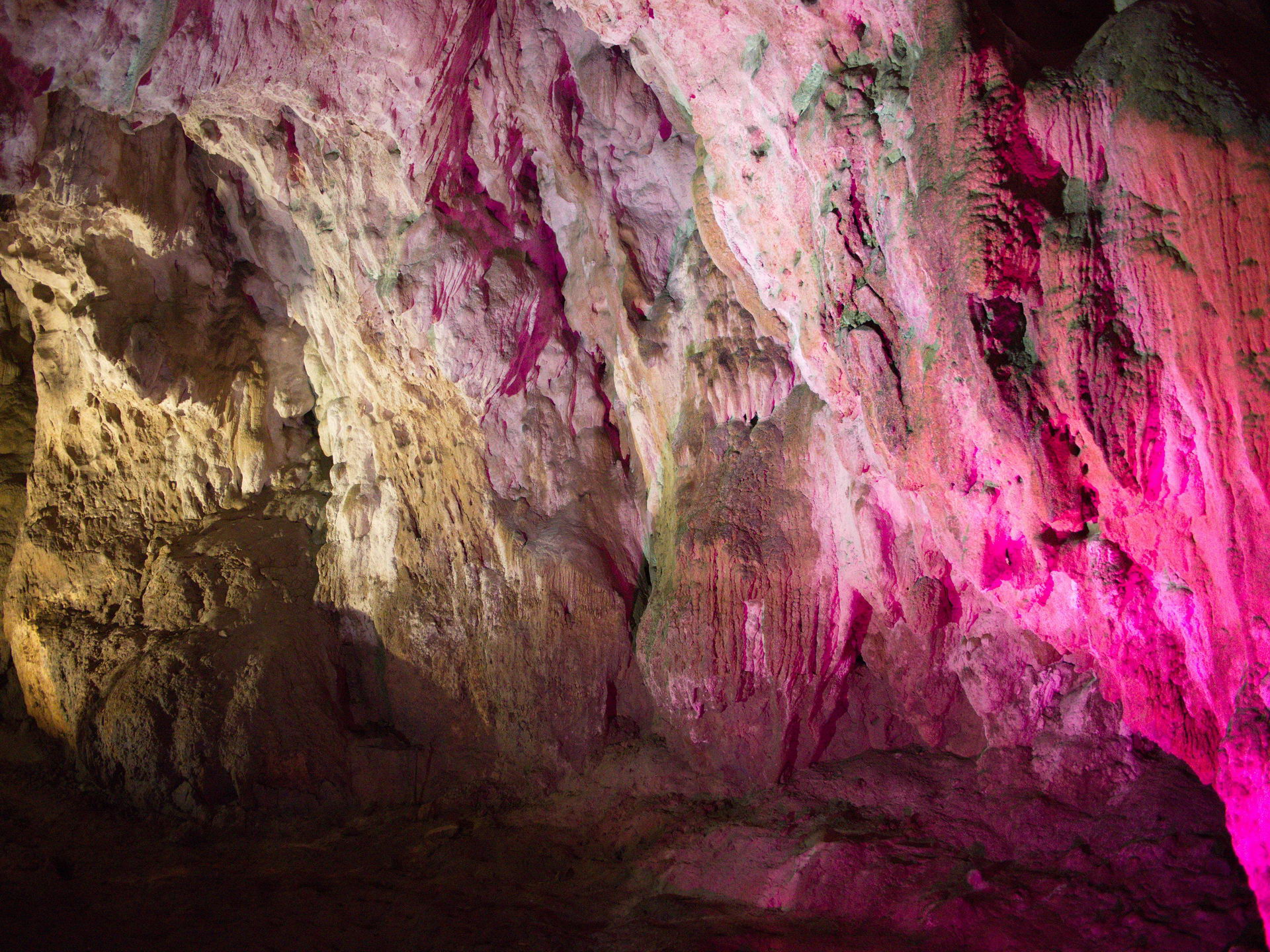
Simpatica e prepata la nostra guida, Silvia se non ricordo male il nome, che ha reso la visita piacevole ed interessante. Ci ha spiegato come alcune pareti sembrino dorate a causa di un batterio, ci ha mostrato formazioni calcaree nascoste, ed ha risposto a tutte le domande che gli abbiamo fatto. Molto brava.
Potete visitare le grotte in due modi: sulla comoda passerella senza alcun tipo di attrezzatura, oppure scegliere la visita speleologica con caschetto e stivaloni, forniti da loro, per scendere in profondità in tutta sicurezza.


Monte Serrone
- Dettagli
- Scritto da Manuel
- Categoria principale: Italia
- Visite: 12262
Escursione: Da Campoli appennino a Monte Serrone (1.974m) - sentiero a destra Q2
Luogo: Campoli Appennino, Sora, Pnalm. (ex ristorante Cicerone)
Condizioni Meteo : Soleggiato
Difficoltà: Escursione molto lunga e con dislivello elevato 1100m. Alcuni punti sono da fare a quattro mani. Verso la vetta presenza di vipere.
Durata: 7h00m - Giro ad anello
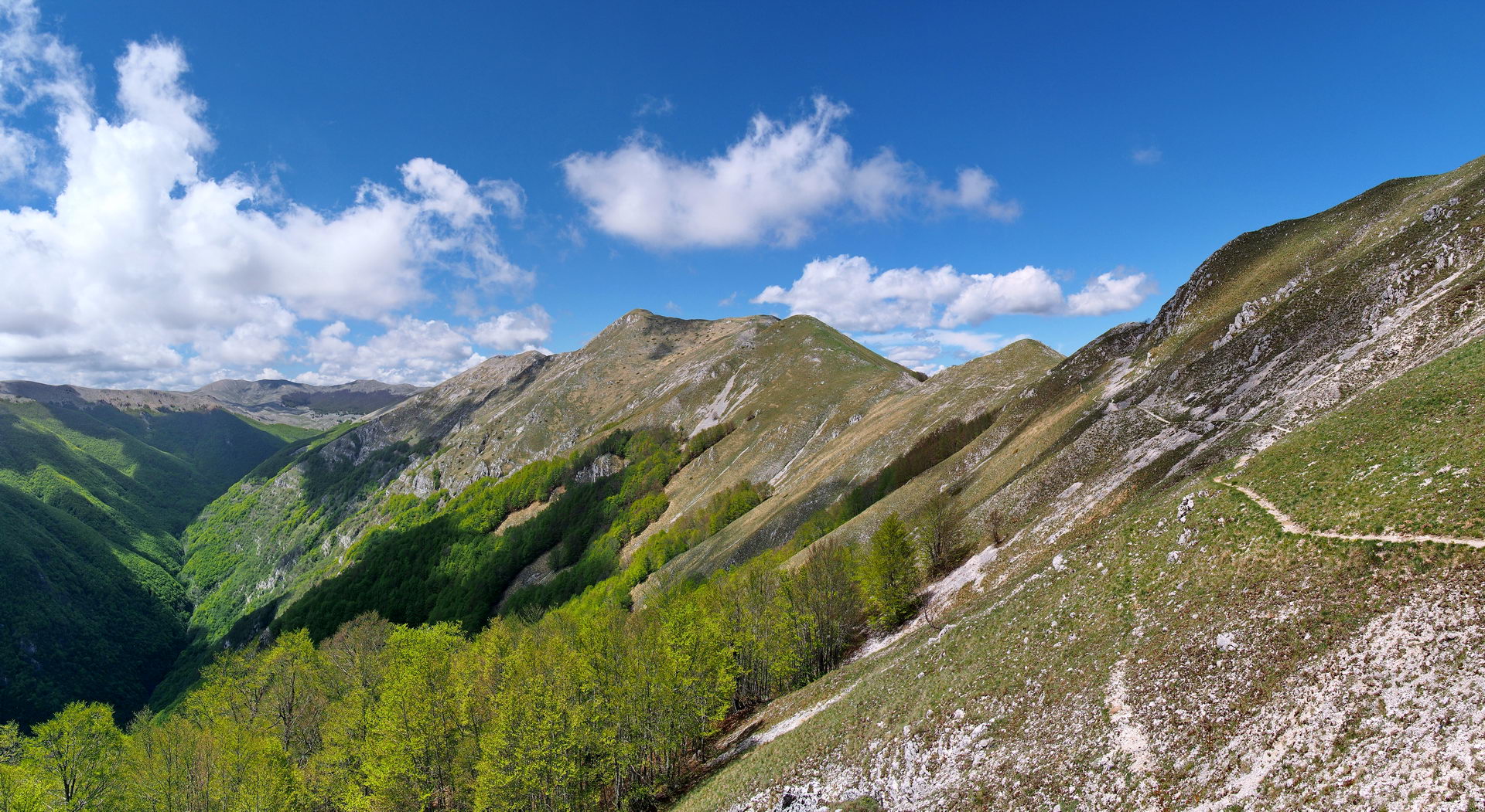
Panorama: 4,5/5 – Superata la faggeta si percorrono gli ultimi chilometri tutti in cresta, cosi il ritorno. Veramente Un panorama fantastico.


14.7 km, 06:33:39

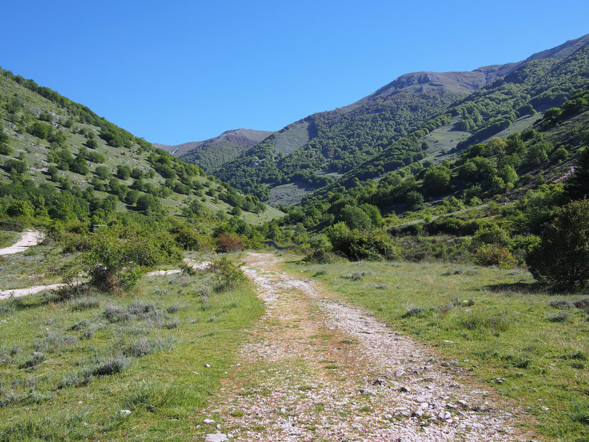
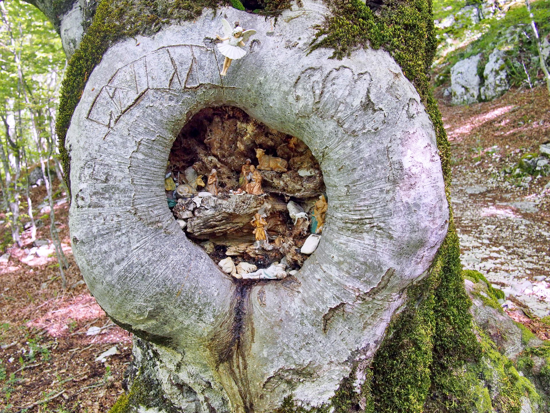
Insieme all'amico Marco Pantanella e ad altri simpatici escursionisti, Michela, Alessandro e Fulvio, partiamo da Roma in direzione Sora, più precisamente Campoli Appennino, per affrontare una lunga ma bellissima escursione nel Parco Nazionale d'Abruzzo, Lazio e Molise. Si parte nei pressi dell'ex ristorante Cicerone, mettiamo gli scarponi e ci avviamo sul sentiero Q2, a destra, a circa 950m . La prima parte del sentiero è semplice e sale su una mulattiera larga e comoda, fino ad inoltrarsi nella faggeta dove prosegue comoda ancora per qualche chilometro. Dopo aver superato il rifugio Simoncelli (tenetevi alla sua sinistra) fate attenzione agli alberi a sinistra, in un nodo di uno di questi bellissimi faggi è stato allestito un piccolo presepe.
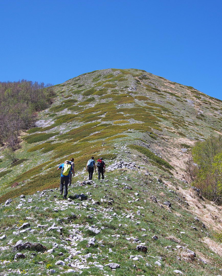
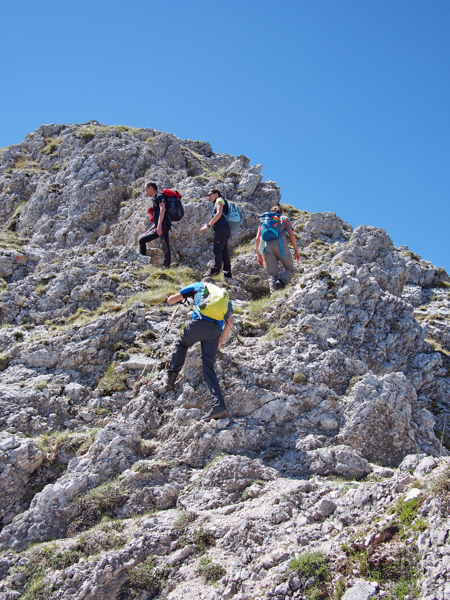
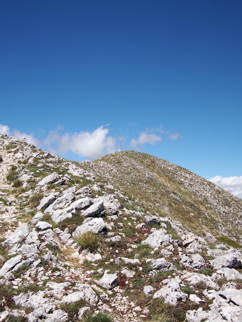
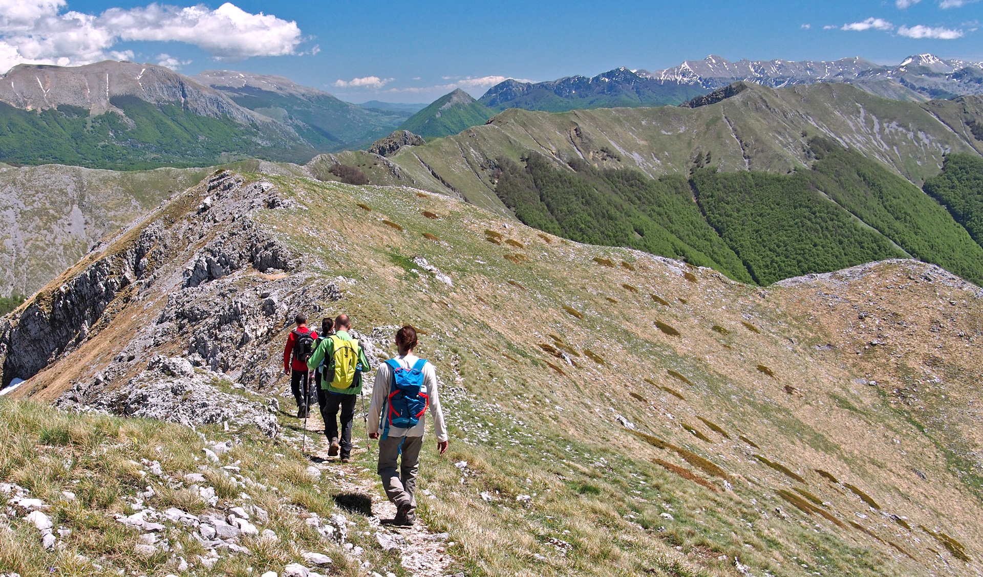
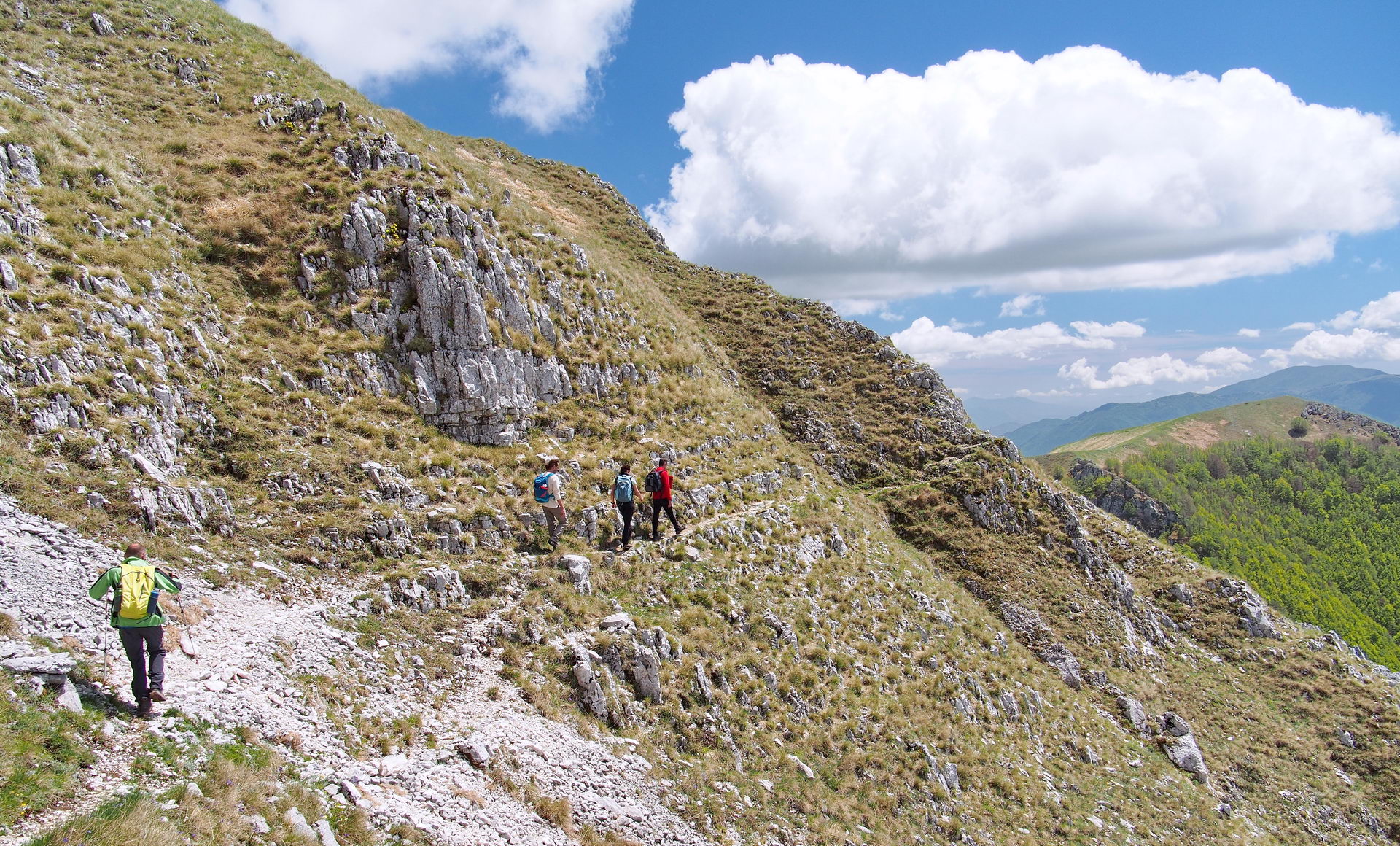
Si prende poi una deviazione nel bosco per uscire dalla faggeta. La pendenza sale, ma in una mezz'ora arrivamo alla prima croce che si incontra in questa escursione, e primo punto panoramico da cui è possibile vedere tutta la vallata appena percorsa. Il percorso da qua è tutto scoperto, bellissimo e panoramico. Ma il livello di difficoltà sale. Non c'è più la comoda sterrata, ma si passa su crinali pieni di rocce, fino a quando, superata una piccola collina, si riesce a vedere il Monte Serrone e la sua vetta, meta dell'escursione.
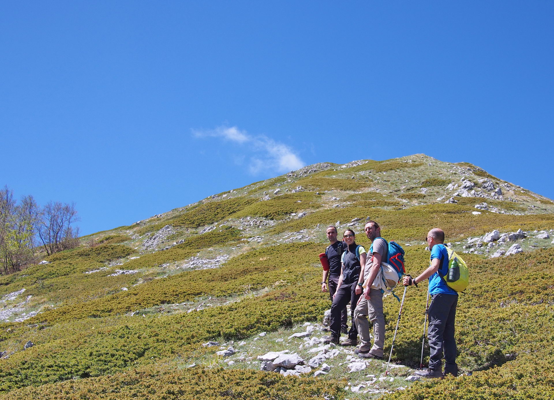
Nella foto qui sopra si vede il sentiero che taglia la montagna e raggiunge la vetta. Quella è però una delle due vie possibili ma non quella scelta da noi. Marco ci guida sulla cresta di sinistra, fino in cima e poi da li raggiungiamo, sempre in cresta, la vetta del Serrone. Attenzione perché questo è territorio di vipere e proprio Marco per poco non ne calpesta una. Finalmente arrivati in vetta è tempo di fare un meritato spuntino.
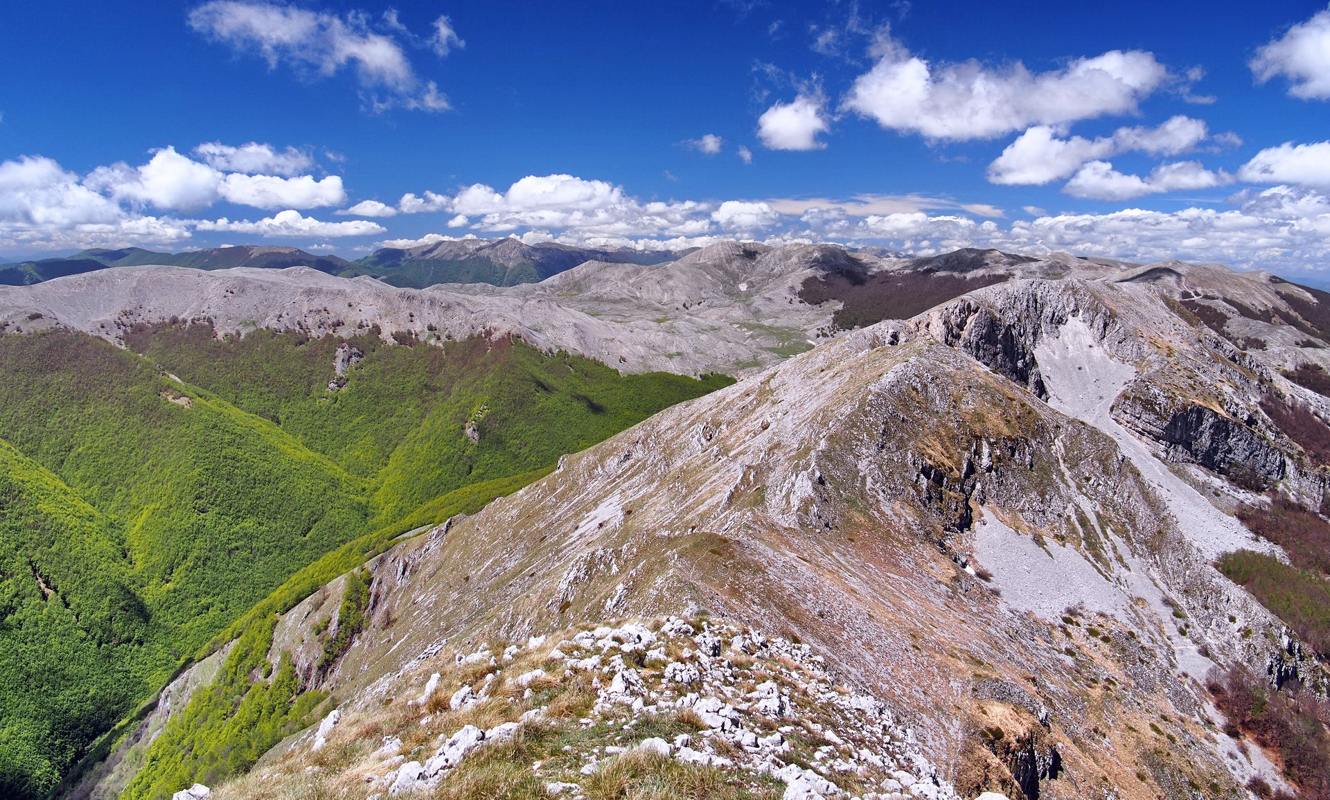
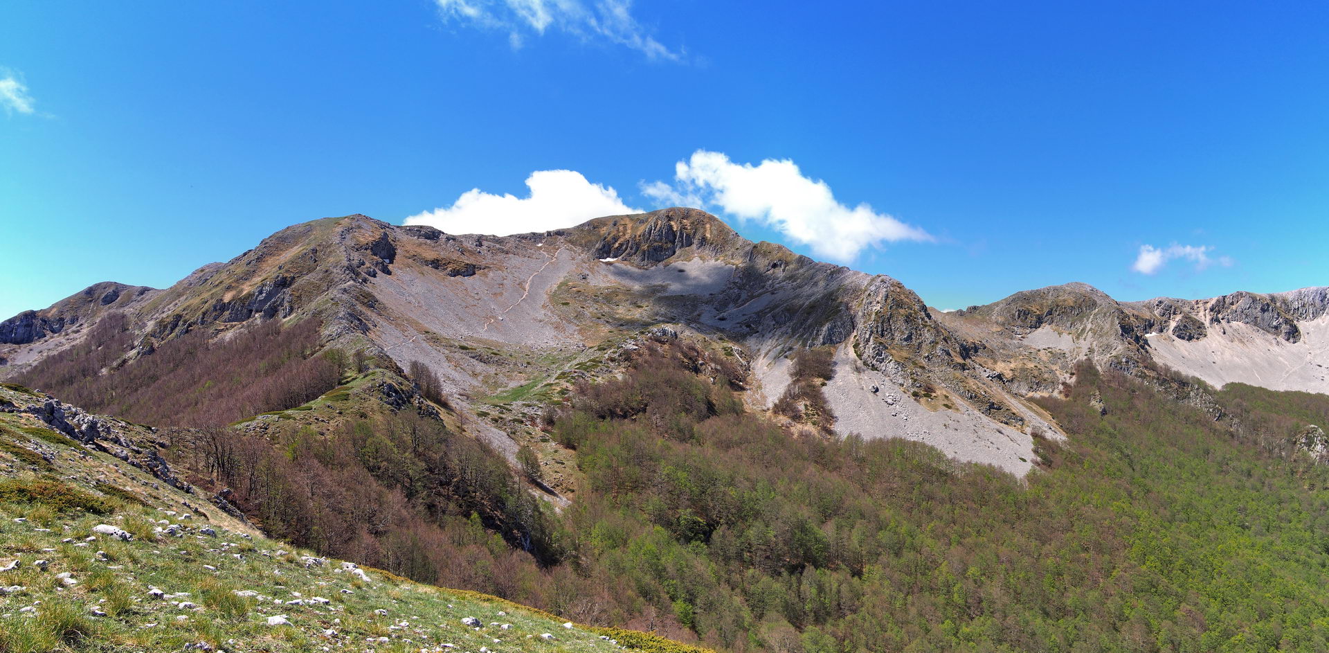
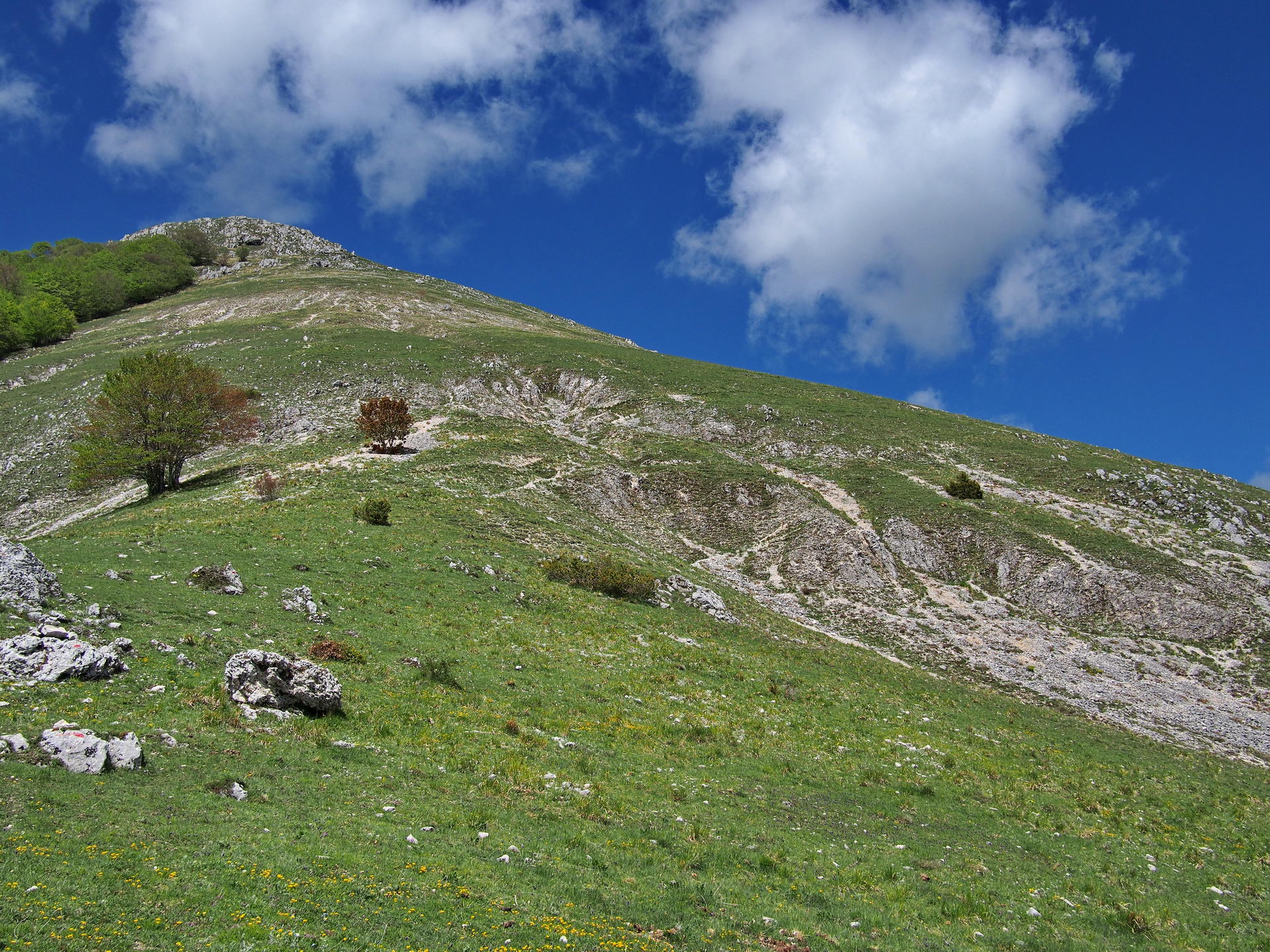
Scendendo ritroviamo la vipera dell'andata sullo stesso sasso, a prendersi quel sole che prima gli avevamo negato. Anche stavolta come si accorge della nostra presenza si allontana velocemente. Scendiamo per un breve tratto sui passi dell'andata, poi continuiamo sulla destra, senza mai lasciare il sentiero di cresta. Dobbiamo percorrerla tutta fino ad arrivare sotto un'altra vetta, Punta Mazza, e da li scendere con molta attenzione fino a rientrare nella faggeta. Attenzione in questo punto, la presenza di foglie secche e l'estrema pendenza può rivelarsi difficoltoso. Mani libere per eventuali scivoloni. Prima di scendere mi prendo il tempo di una foto di tutta la cresta appena percorsa.
Tornati nella faggeta il sentiero prosegue senza grosse difficoltà, ma scende molto più gradualmente di quanto non sia salito all'andata, passando per pascoli di cavalli e radure che intervallano il bosco. Bellissimo l'incontro con le neo mamme a quattro zampe e i loro puledrini. Purtroppo temo siano cavalli da macello.

L'ultima parte della sterrata è davvero lunga. Decidiamo di tagliare e concederci un pò di "avventura". L'impresa riesce, risbuchiamo sopra il ristorante, ultima curva e di nuovo tutti a casa.